Clean, clear, simple, printable.
Some of the links in this post are affiliate links. This means if you click on the link and purchase an item, I will receive an affiliate commission at no extra cost to you. All opinions are my own.
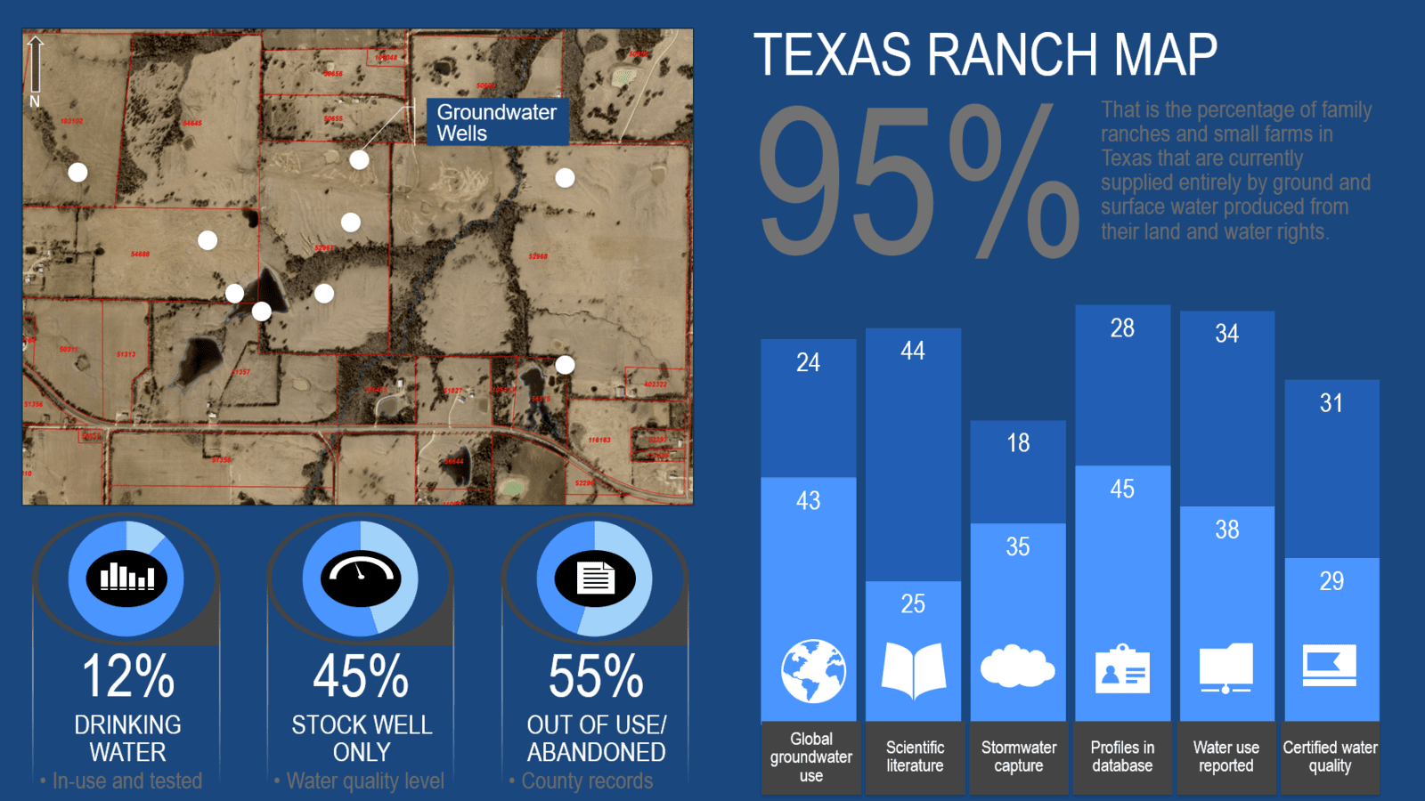
The map below was created using the United States Public Land Survey System (PLSS) grid of township, range, section, and quarter sections. Then county property data were added to show the division of plots by landowner (labeled in red text). Google Earth aerial view is the backdrop for the map.
Creating infographics can quickly turn your map into a visually appealing piece more easily digested by readers.
Affiliate Links